 English
  Cymraeg
Whitchurch History Cymru
Where are 'The Crossroads' in Whitchurch?
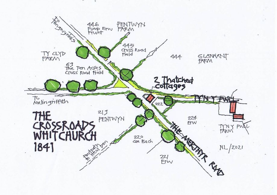
In 1841, The Crossroads were a very important spot, located at the junction of the Merthyr Road and Ty’n y Pwll Road where the Library now stands. Back then, there was just one building on the crossroads, a pair of very small and very old thatched cottages surrounded by fields.
The sketch below shows an aerial view of how the crossroads might have looked in 1841, at the time of the Parish Tithe Map.
The roads would have been dusty stone-finished (probably with lots of ruts and potholes), no pavements or kerbs, and the grass verges and hedges would have been roughly trimmed, with occasional gated openings into the fields behind. Ancient trees would have been growing in the hedgerows.
The crossroads formed the junction of at least 3 farms, Pentwyn, Ty-Clyd and Glannant and the individual fields mostly had names. Where the Library now stands was a Ty-Clyd field called ‘The Ten Acres Cross Road Field’!
The site of the 2 thatched cottages is now the Velindre Cancer Charity shop (Jennifer’s Gown shop as was), and field number 69 has the Library and the Library Park behind. There is no roundabout, shops, houses or the Methodist Chapel.
What else is missing?